Archaeological and historical background to present day
This area is classified on the Cornwall and Scilly Historic Environment Record (HER) as ‘anciently enclosed land’ (AEL). AEL is land which is likely to have been enclosed from late prehistory onwards and is generally considered to have a high potential for the survival of buried archaeological remains dating back to prehistoric times.
A possible ’round’ (a feature indicative of Late Iron-age or Romano-British period settlement) lying some 200m to the north; may suggest early occupation in the vicinity though the feature may also be interpreted as a Lann (an early medieval ecclesiastical enclosure). Place name evidence suggests the former presence of a standing stone approximately 1km to the north, whilst three further possible rounds, a hill-fort and an enclosure have been identified within 2.5km of the village.
A number of local place-names including Tresillian and Tregeagle may suggest settlements existed here in the early medieval period and the old manor of Polsue, in which parts of the modern village lies, clearly predated the Norman invasion. The Domesday book records that the manor was held by Alwin before 1066, and he paid tax for 1 hide (120 acres of land) for 10 ploughs, 5 ploughs there, 8 slaves, 8 villagers and 14 smallholders. This land also included woodland totalling 15 acres, and 3 acres of pasture measuring 3 leagues long and 1 league wide. On this land he kept 10 pigs, 100 sheep and 10 goats.
By 1086, the manor of Polsue was held by Richard son of Thorolf from Robert the Count of Mortain (half-brother of William I ), in 1471 it was forfeited by John Vere, Earl of Oxford, to Edward the Fourth, and then it passed through the families of Mapowder and Luttrell to Doctor Wynne and then to Mr. Pendarves (Gilbert, 1838, pp402-403). The manor and the ecclesiastical parish of St Erme in which it lay, consisted of two portions, with the Northern part centring on the church and comprising the church town land of Eglos-Erme, Trispen Vean and the Vean of Pengilly, and the Southern part of some 400 acres, a detached portion, comprising the Barton of Polsue, and the lands of Tregoning and Tresillian Farm. The northern portion of the manorial land was free land, with the southern portion including parts of today’s Tresillian being the main domestic part of the manor. Polsue Manor Farm the site of the manor house, lies to the southwest. The extant building Polsue Manor (Listed Building 62811) is described as a farmhouse dating to the 17th century or earlier. There is evidence of medieval strip farming activity in nearby fields and it seems likely that much of the flatter land close by would have been given over to the plough for much of the medieval period with more exposed slopes used for pasture.
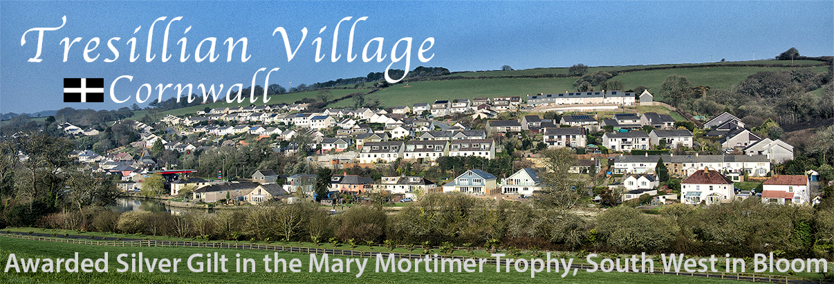
The hamlet of Tresillian is first recorded according to the SMR (PRN 22567) as “Tresulien” in 1201 (citing Padel, OJ. 1985. Cornish Place-Name Elements. 314) or in 1315 (Gover 1948, pp472-473) or 1325 (Padel 1988, pp169) as “Tresulyan”, meaning the farm of Sulyen or Sulian. The hamlet developed alongside and around an important crossing point of St Clement’s creek (Tresillian River) over which a bridge had apparently been built by 1386 when the settlement was referred to as Ponstresilyan (Gover, 1948, pp473). This bridge served the main Truro to St Austell road along which the hamlet developed, as does the more recently constructed bridge that now carries the A390 across the river just at the point where it becomes non-tidal.
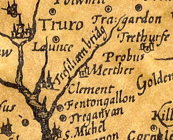
The 14th century Wheel Inn (Grade II Listed Building 62799) is reputed to have been Thomas Fairfax’s headquarters at the time of the English civil war when the opposing sides sides met at Tresillian Bridge (the then name of the area now known simply as Tresillian). On March 10, 1646 a treaty was agreed between Fairfax (Parliamentarian) and Lord Hopton (Royalist), whereby the County of Cornwall was surrendered to the Parliamentarian forces. Lord Hopton’s forces having previously been heavily defeated during an earlier engagement with Fairfax at Torrington and were by now in no fit state to continue the conflict. The Inn is of typical stone and cob construction of the time with wooden lintels and a thatched roof. The map shown here is from 1650, with the area now known as Tresillian marked as the tiny hamlet of Tresiliam bridg, and the much larger village of Merther as the main settlement in the area at the time.
A small stream (actually a leat) runs under the A390 and into the Tresillian River alongside the Wheel Inn. This feature has been referred to as the ‘Gylly’ in the parish of St Erme Bounds of 1613. A ‘gilly’ is defined as a grove (Holmes, 1998, pp21) whilst a ‘gill’ is defined in the Oxford English dictionary as a “Deep, wooded ravine, or narrow mountain torrent” (Coulton, J 1984). Either interpretation may be appropriate here. The ‘Gylly’ fed the former mill race for the Wheel Inn at the bottom of the hill.
The tithe map and apportionment of 1840 show the site as an arable field called Higher Meadow, occupied by Ann Langdon and owned by Edward Pendarves who was evidently Lord of the Manor of Polsue. The surrounding fields were all used for arable at this stage and were listed in the tenement of Gillises. By this date Tresillian was becoming relatively well developed along the roadside including quays, lime kilns, malt houses, the Wheel Inn and a toll house.
By the 1880s a school, a blacksmiths workshop, a mission chapel (erected 1878- Kelly’s Directory 1930) a non-conformist chapel, a corn mill and a number of houses had been constructed alongside the road and on reclaimed land on the north side of St Clements creek (Tresillian River). Kelly’s directory of 1883 records “The lordship of the manor is in the Pendarves family…and the chief crops produced are wheat, barley, oats and turnips.” Charles Gatley is the only farmer listed at Polsue within the ecclesiastical parish of St Erme. The growing of cereals as well as fodder crops were clearly very important in the area as well as lime burning. Coal and timber were other important commodities traded by river.
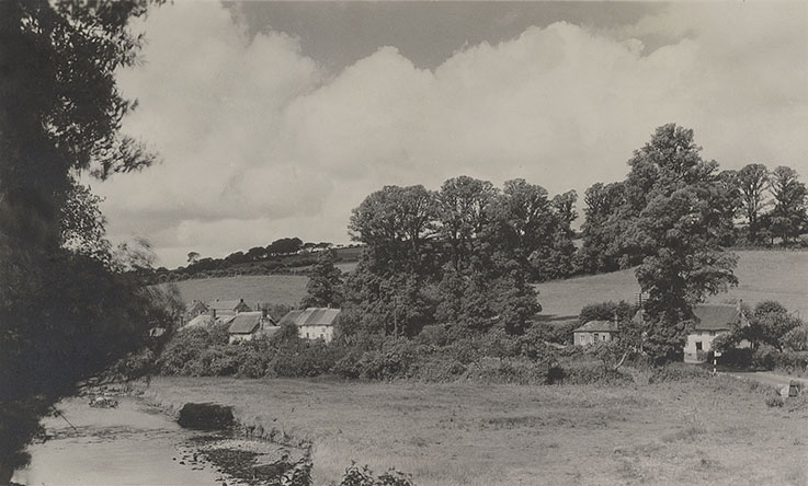 Tresillian c1930s. Photo: © Author unknown, as original print does not have identifiable imprint. See full story regarding sender of post card on our Tourist Information page.
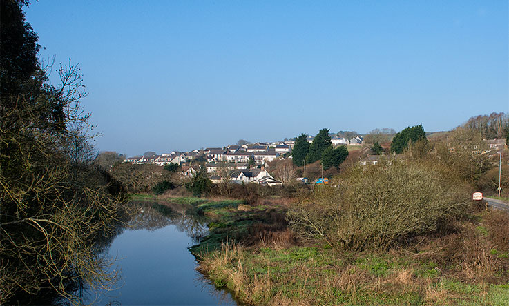 Picture taken April 2015 from similar viewpoint on Tresillian Bridge. Photo: © Keith Littlejohns.
By the turn of the 20th century commercial trade by river transport had begun to dwindle and decreased rapidly as the century progressed. This was largely due to the main A390 road being by now a superior route to the village, and the facts that most of the old trades that relied on bulk transport had ceased operating and continuous silting of the Tresillian River made navigation less viable.
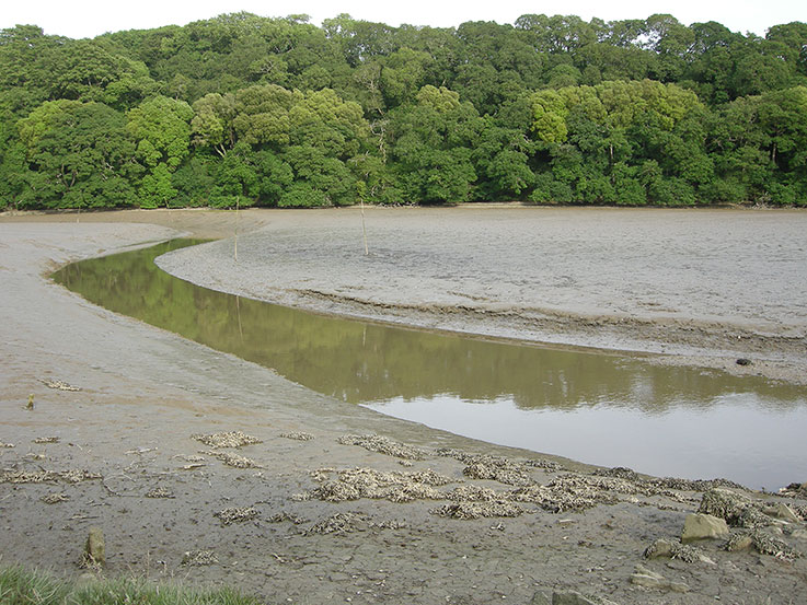 Tresillian River at low tide when the usually broad expanse of water is reduced to a narrow ribbon winding its way up to Tresillian Bridge. Photo: © Keith Littlejohns
The mid to latter part of the 20th century saw the rapid expansion of housing development creeping up the hill away from the river, with building schemes in the 1970s and 1980s covering possible archaeological areas of interest. About half a mile outside the village along the A390 to the east at Denas Water is the recently established Tresillian Business Park, a modest light industrial complex.
The fields and steep sloping woodland between Heron Close and Fairfax Road/Lower Park, that had until the late 20th century been used as a sometime grazing area for sheep and pasture for horses, now form a thriving natural wildlife habitat and essential corridor between farmed land and housing development. The aforementioned ‘Gylly’, or leat, is part of this landscape and is used by protected species such as frogs, toads, newts and slow worms (actually not a worm or snake, but a lizard) that nest in its banks. In the surrounding mixed woodland area there are large swathes of naturalised English bluebells among trees and shrubs essential to nesting birds.